| Type of Route | Arrow | Distance | Grading | Estimated Time | Total Climb |
| Linear Walk | Yellow | 10 km (one-way) | Easy to Moderate | 2.5 hrs (one-way) | 80 m |
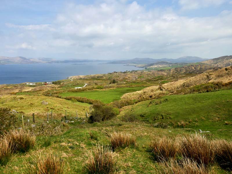
Goleen to Toormore Loop Walk is along quiet country roads and forest tracks with great views, which include Dunmanus and Roaring Water Bay. From the mapboard at Goleen, follow the yellow arrows for Fastnet Trails down past Goleen Pier, and on along a quiet boreen. At the T-junction on the R591, turn right heading east for 200m, before truning right onto another quiet boreen for another 1.5km. The trail then crosses the R591 before following quiet roads under Knockaphuca Hill, past Dunkelly and Gottyownen, returning through the quiet forest track to Toormore.
Take Note
🥾This walk is graded as Easy to Moderate
🐕🦺Dogs must be kept on a lead at all times.
Walk Guide
The Goleen to Toormore Loop Walk route is marked with amber arrows which you need to look out for.
Starting at the trailhead (12) in Goleen you need to cross the road and head down towards the harbour. Very soon you will come to a small bridge over the stream and you go STRAIGHT ON up the hill past the Heron’s Cove restaurant and B&B. The road winds for about 500m and you emerge onto the R591 and turn RIGHT uphill (11) for a few 100m. At the first opportunity turn right onto a quiet side road.
Follow this narrow road for about 1km and it will sweep sharply LEFT at a rural cross roads (10). Continue north and after about 700m you emerge onto the R591 again (9). Cross with care and turn LEFT (back towards Goleen) but almost immediately veer RIGHT onto a narrow path through trees, which soon emerges into a stony road and then a public road (8). You should be able to see a workshop building on your right and you continue keeping to the RIGHT.
Follow this road northwards, enjoying views of the rugged Knockaphuca on your right. Look out for a recently restored building on your left with STORE over the door. Soon after the road begins to descend and gives views over Dunmanus Bay. The road steepens and swings sharply left to reach a junction (7) where you must turn RIGHT.

Now follow the coast road for about 3km as it descends gently from Dunkelly to Dunmanus castle with great views of the sea and the Sheeps Head peninsula. After the castle you’ll soon see Dunmanus Pier (6) and then you continue east for just over 1km, ignoring side roads, until you reach the R591 again (5).
Turn right and follow the R591 with care for just over 1km looking out for a side road (4) to the LEFT soon after passing a restored schoolhouse on your right. Take this LEFT turn and look for a small gate on the RIGHT after about 50m.
This brings you onto a wide stony road between fields which heads due south for about 500m. Now look for another small gate alongside the stream on the LEFT and follow the path up along the side of the field until eventually you emerge through a third small gate onto a track.
The track climbs briefly past a house entrance and then levels off and very soon descends steeply to a cross roads (3). Now turn LEFT and follow the public road steadily uphill for about 500m when it levels off and descends again briefly. As it levels off at the bottom you are crossing a small valley and you’ll see a field gate (2) to the right with signposts to Toormore. Follow the path down the valley and this will bring you to Altar Church and the Toormore Trailhead (1).
If you plan to continue to Schull (or Lowertown) you could continue straight on at (2) to avoid backtracking.

